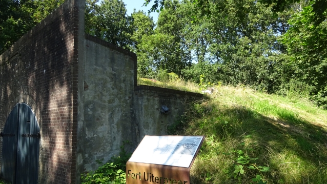
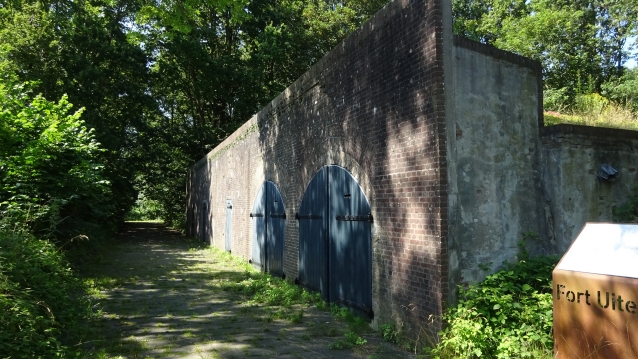
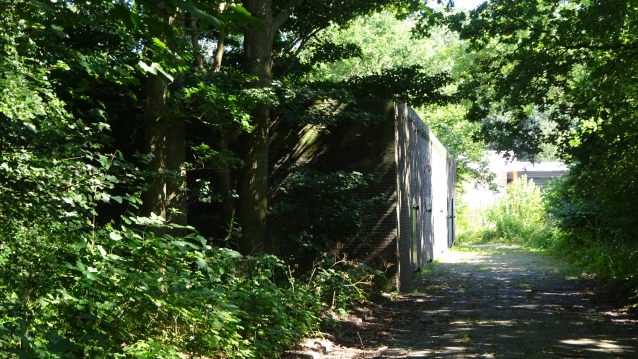
The Fort Uitermeer is an old fort that was included in the Nieuwe Hollandse Waterlinie (New Dutch Waterline) and later the Stelling van Amsterdam (Defence Line of Amsterdam). It is located in the North Holland municipality of Weesp on the east bank of the Vecht, southeast of Weesp near the hamlet of Uitermeer. To the southwest lies the Fort at Hinderdam and to the northwest the Vesting (Fortres) Weesp.
The fort’s purpose was to protect the land passages between the Naardermeer and the Vecht. The two most important passages were the Railway Amsterdam – Amersfoort and the road from Hilversum to Weesp (along the current N236). It could also support the neighbouring forts with its guns. It also protected the lock with which the land could be flooded.
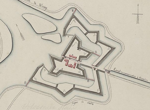
The Torenfort (Towerfort)
Around 1589, a redoubt was built on the site of the current fort to defend Weesp. After the digging of the ‘s-Gravelandsevaart and the construction of the lock, the Uitermeersche Schans became a link in the Oude Hollandse Waterlinie (Old Dutch Waterline). In order to flood the lock, which had also been given a role to flood the land between the Vecht and the Naarden fortress, the redoubt was reinforced into a fortress in 1673. The fort did not lead to any change for shipping traffic, which could still use the lock. The shooting had to be paid for: two pennies for a large ship and half a penny for fishing and milk ships.
In the autumn of 1787 the Prussian invasion took place. The Prussian army advanced and on 17 September the fort fell without a fight. A Prussian reconnaissance unit, consisting of a luitenant, 40 horsemen and 16 snipers, approached the fort. The fort was only manned with six soldiers and a sergeant. It was raining and the defenders were sheltering in the guardhouse. They had left the guarding of the fortress bridge to a farmhand. This servant lowered the bridge after the lieutenant had spoken forcefully to him.
Construction of the towerfort
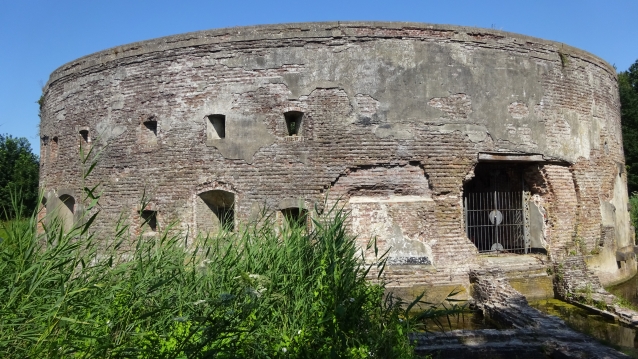
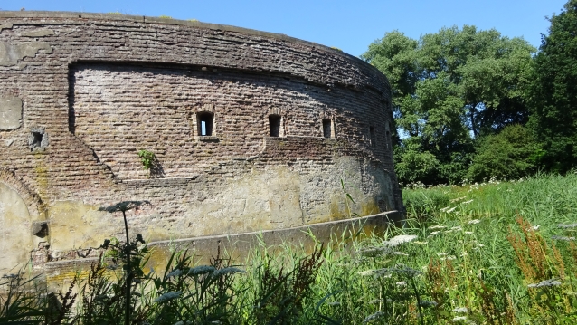
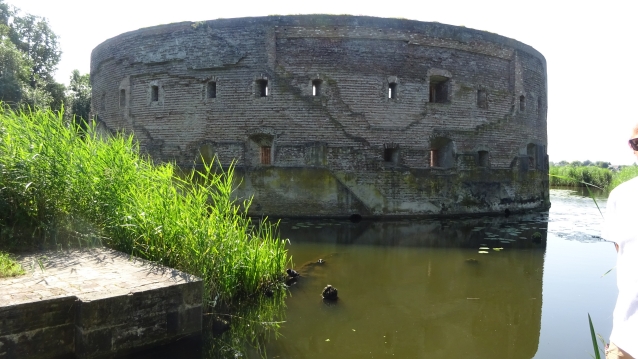
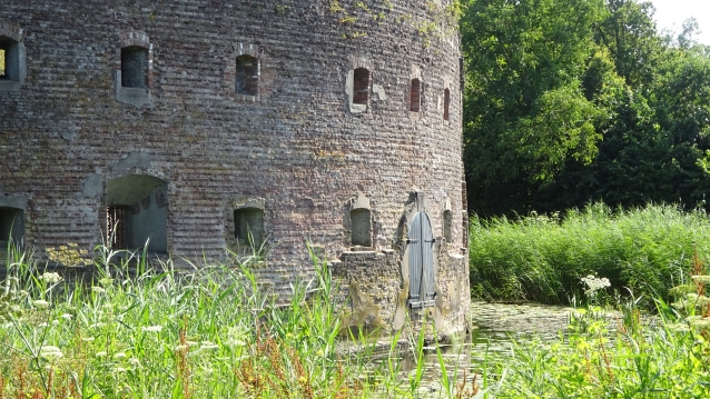
In the French period, the fort fell into disrepair and this was only reversed in 1845. In that year, a tower fort was built on the site, the first example of a series of three. Two others came to the Ossenmarkt in Weesp (built in 1861) and at the mouth of the Vecht in the Zuiderzee near Muiden, the West battery (1852). The tower fort has a diameter of about 30 meters and had two floors. There was an open courtyard and a staircase ran along the wall. On the floor were 12 rooms with 10 british per room. Each room, including on the ground floor, had three loopholes in the outer wall. On the ground floor there were five more rooms for the men and further rooms for the guard and commander, an infirmary and warehouses for the storage of ammunition and food.
End of fortification
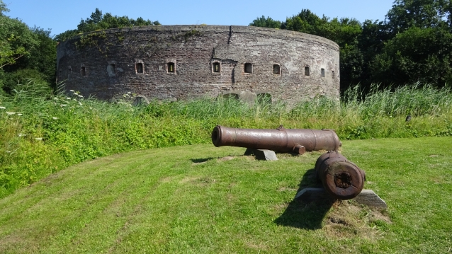
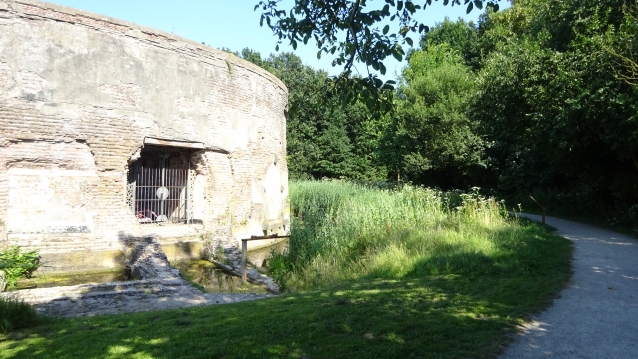
On 25 January 1951, the fort was designated by Royal Decree as “fortification of no class”. In 1954, the 102 Company Mechanical Equipment of the Engineers stationed in Wezep was ordered to demolish the fort and level the ground. They arrived at the beginning of the year. First, the soil was excavated from the embankment that lay against the tower fort. The soil was used to dampen the fort moat and expand the site. The entrance gate to the tower fort was blown up in June 1954 and the bunkers followed in the summer. The blowing up of the tower fort was only partially successful, only the outer walls of brick are still standing. The gun depot from 1874 was also retained, but the ground cover was removed.
52°17’35.7″N 5°04’53.8″E

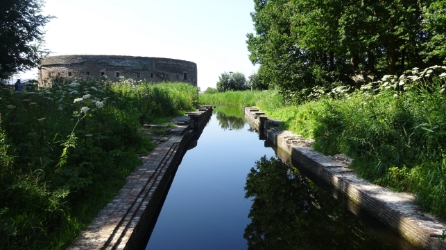
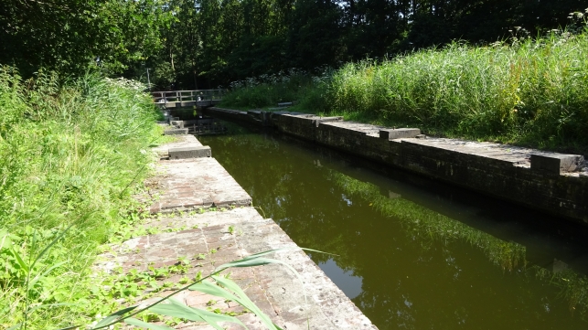
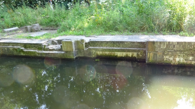
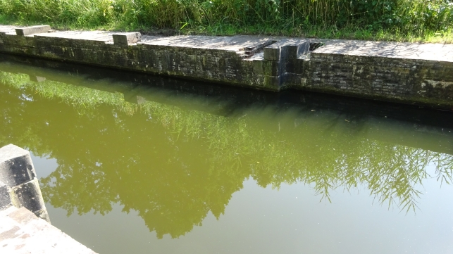
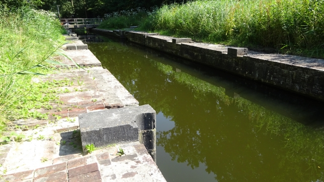
Inundatiesluis & Zwaaikom (Inundationlock & Turn bowl)
On old drawings, the Uitermeer Foundation found a few years ago a lock with a swing bowl where ships could turn. During the subsequent excavation work, the quay of the lock turned out to be intact.
The lock at the fort served to compensate for the height difference in water level.
The lock was part of a sailing route from the ’s Gravelandsevaart to the Vecht.
The ‘s-Gravelandsevaart was dug in 1634.
Over this watercourse, wealthy Amsterdam merchants were transported to their country estates in ’t Gooi. From the other side, peat was shipped to Amsterdam.
This lock, together with the redoubt and the fort, was intended to hold up the enemy by flooding the land between the Vecht and the Naarden fortress.
The lock and redoubt were reinforced into a fortress in 1673.
52°17’35.4″N 5°04’56.9″E
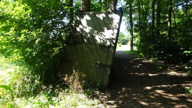
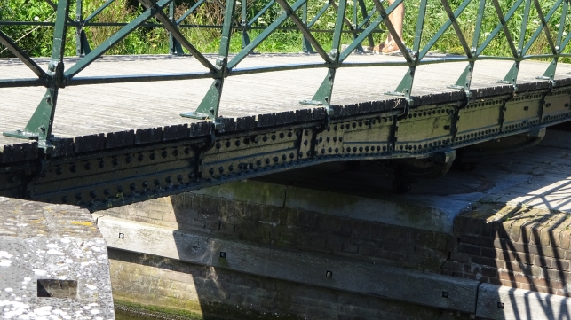
Lock gate
This lock gate gives an impression of what the lock gates that have been in the lock here must have looked like. Because the lock and bowl have been under the sand for two centuries, this is of course not an original one.
52°17’36.3″N 5°04’56.8″E
House Martinstil
This hoist is specially made for the house martins on this property.
And if you think what is that sound. This sound should lure the swallows to this lift.
52°17’37.6″N 5°04’54.3″E
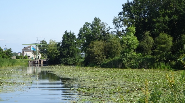
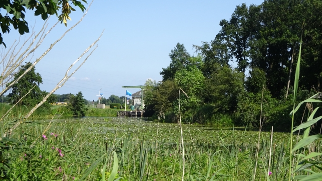
The new Lock
In 1878, the lock, which ran directly along the tower fort, was moved to the north side of the fort. The ‘s-Gravelandsevaart was led around the fort.
An occupation of about 175 men had to guard the inundations lock and defend the two important – higher – access roads to Amsterdam, the Railway Amsterdam – Amersfoort and the canal with the adjacent road.
52°17’40.4″N 5°04’54.7″E
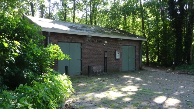
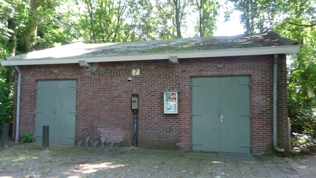
Plofhuis (Flophouse)
The site remained in use by the Ministry of Defence. The freed-up space on the fort was used for the construction of ammunition warehouses. Scattered around the site are still small magazines for the storage of ammunition or plofhuisjes.
The name plofhuis refers to the fact that if the ammunition in the plofhuis would explode, only the roof would come up. And do not blow the walls out by the blow, this because the roof rests loosely on the side walls.
The Plofhuis number 7 is a theatre/film house.
52°17’37.0″N 5°04’58.0″E
Nature info display
This info display gives an impression of what animals and insects can be found on this site.
52°17’33.5″N 5°05’00.2″E
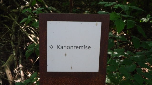
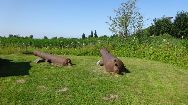
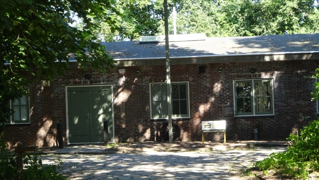
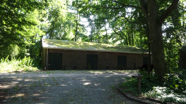
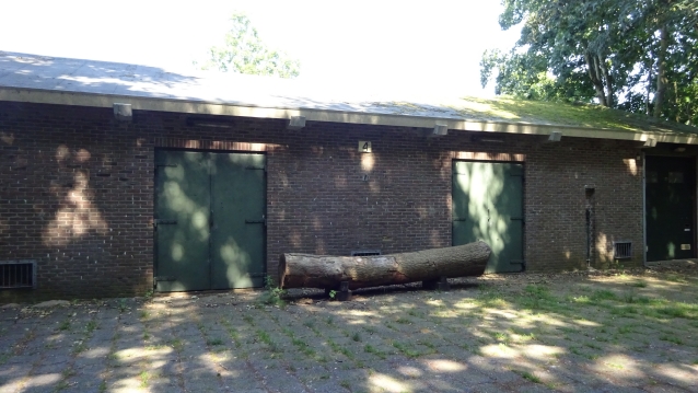
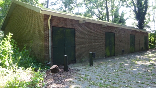
Kanonnen opslag (Cannon storage)
The gun depot was built in 1874.
Inthe thirties, several group shelters and bunkers were built east of the fort. The shelters were in the field and between the trenches. In the event of a hostile shelling, the soldiers could take shelter there. The bunkers were strategically located, particularly along the railroad, and were given either a machine gun or cannon to keep the enemy at bay.
The Netherlands surrendered in May 1940 and the front line never reached Fort Uitermeer. During the Second World War, the German occupier used the fort as a warehouse.
52°17’32.0″N 5°04’56.5″E
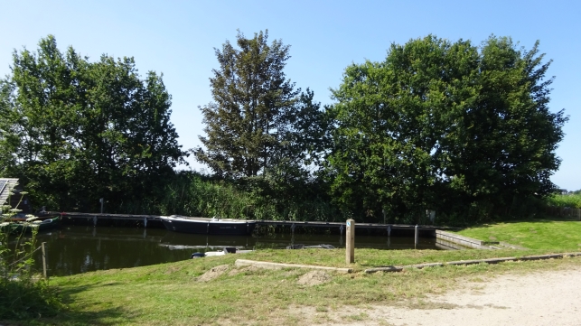
De sloepenhaven (The sloop port)
The sloop harbour offers space for mooring sloops or small boats. In this creek you can also find floating lodges. These are small tent-like houses that you can rent to spend the night in this very special place
52°17’36.0″N 5°04’49.4″E
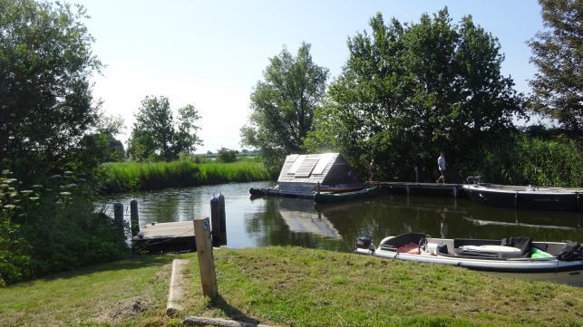
De Botensteiger (The Boat Jetty)
The boat jetty offers space for three larger sloops or small boats. You can walk straight from your boat onto the terrace.
If there is no more space, choose the braking work on the other side. The beach where you are now close to is called the Cow Beach. This is because cows are often enjoying themselves in the water.
From here you have an even more beautiful view of fort Uitermeer.
52°17’37.1″N 5°04’50.6″E
End of this tour.
Time for a drink or somting to eat at PorterHouse Waterfront Restaurants
Thanks for doing this tour
Sources, photos and quotes: Wikipedia, WSPRMP If this list is not complete, please let us know at wsprmp@outlook.com
Intellectual property of
Berry van Raay, WSPRMP Weesp
