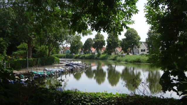
The Vecht starts at the Weerdsluis in the city of Utrecht and flows about 42 kilometers further at Muiden into the IJmeer
De Vecht may have been steaming for 7000 years but certainly for 2000 years at this place. But officially the fighting originated around 600 BC as part of the Rhine Delta and upper reaches of the Oer-IJ. In Roman times, the river was known as Fectio.
The river was from 866 to Muiden in the ownership of the Sint-Martinuskerk in Utrecht. In 1285 Floris V of Holland conquered Muiden and Weesp at Sticht Utrecht
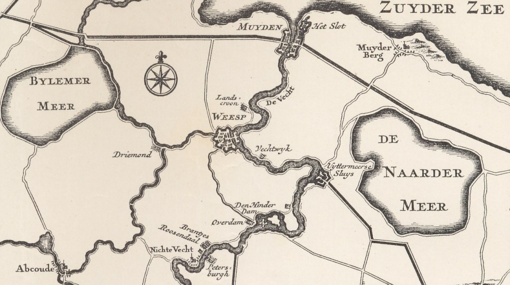
In the Middle Ages, the Vecht was a very important shipping connection between (the predecessor of) the Zuiderzee, from where northern Europe could be reached, and the Rhine, which, among other things, gave access to what is now called Germany. Dorestad (Wijk bij Duurstede) and later the city of Utrecht had their economic flourishing due to this.
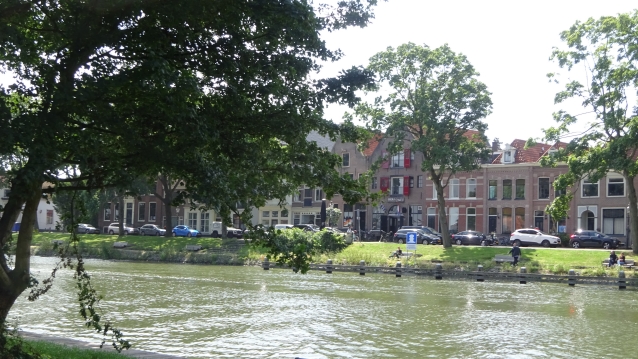
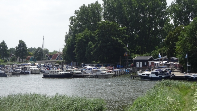
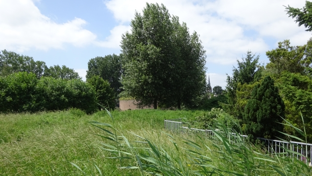
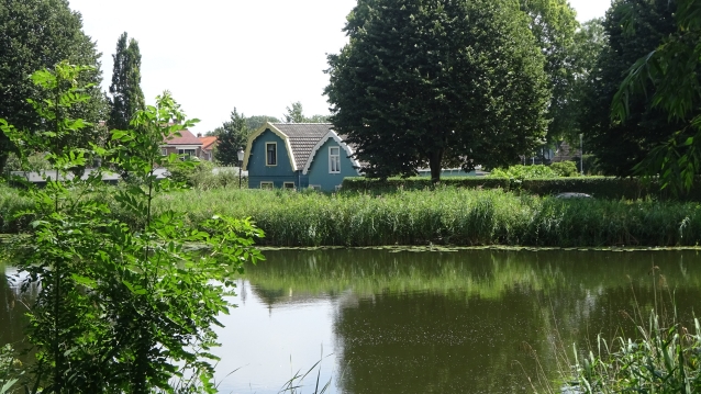
Cafe het Helletje
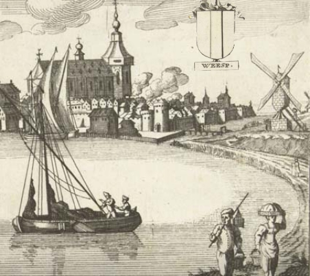
Our yet starts here at café het Helletje. An old café that was already here around 1700. Then, as in many places in Weesp, gin was made here.
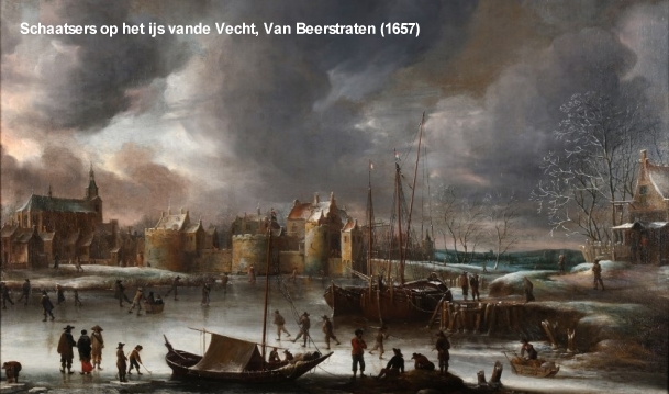
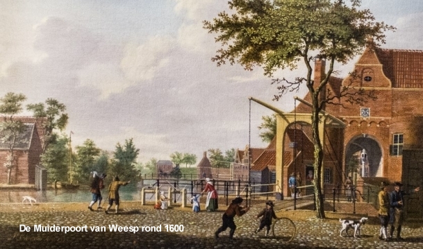
Because the Helletje is located near one of the old access roads of Weesp and because here used to be the Muiderpoort, it can be assumed that it has already had a predecessor. On the painting ‘Skaters on the ice of the Vecht’ by Jan Abrahamsz. van Beerstraten from 1657 can already be seen a stretch (right).
52°18’34.7″N 5°02’35.4″E

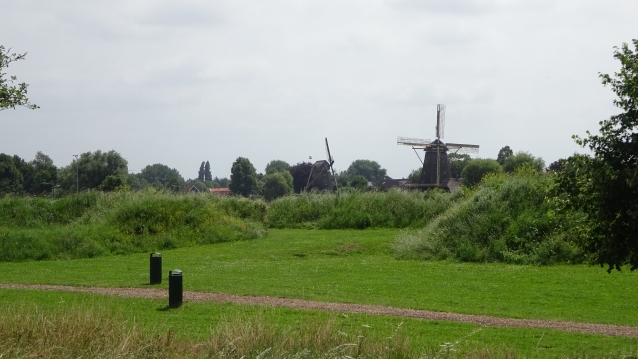
Mills De Bock en de ‘D’ Ouwe Agtkant
Around the year 1600 there were two mills outside the Muiderpoort
De Bock (left) and the ‘D’ Ouwe Agtkant (right).
De Bock is the oldest. And was built around 1470. This mill has often changed its name. Because this mill also bore the name the Vijff Sinnen. And when this very old mill stick had to be renewed in 1772, it was given the name De Hoop. De Hoop stood there until 1833.
Mills not only changed its name but also sometimes moved. For example, ‘D’ Ouwe Agtkant was most likely moved to the Achtergracht, at now Bastion Roosenboom, and continued there as Molen de Roosenboom. During a fierce thunderstorm on August 29, 1783, this mill was hit and went up in flames.
52°18’34.7″N 5°02’35.4″E
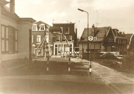
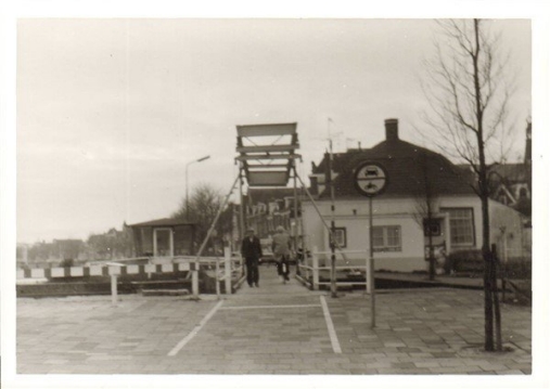

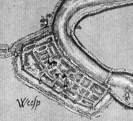
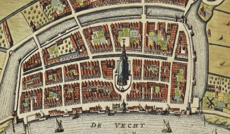
The Muiderpoort and the Sluisbrug
In this painting made in 1657 by the painter Jan van Beerstraten you can see Weesp as seen from the Stationsstraat.This city gate was demolished 180 years ago. source
WN
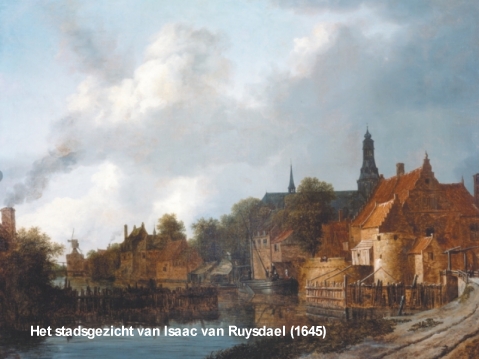
In the painting ‘Thecityscape of Isaac van Ruysdael (1645)‘ you can clearly see the place where the Sluisbrug is now ‘
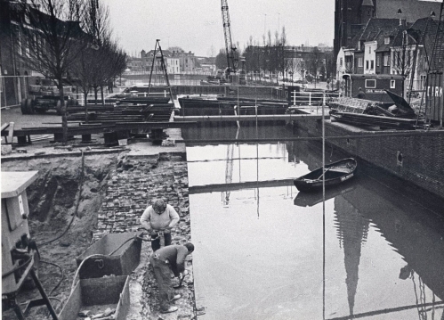
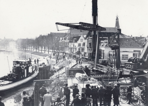
In 1978, the lock between Smal Weesp and the Vecht was restored. This was the reason for the traditional Sluis en Bruggen Feest in Weesp. Still every year in the last weekend of August, the Sluis and Bruggenfeest is celebrated around this bridge and also throughout Weesp.
52°18’32.4″N 5°02’34.1″E
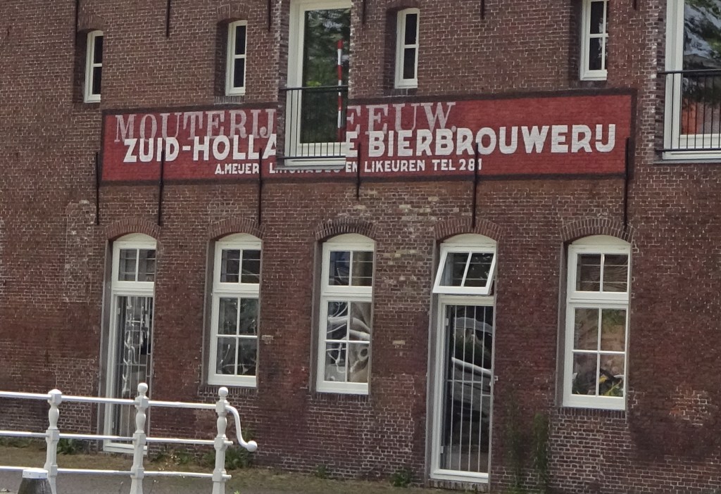
Gin and beer
In the 1700th century, half of the 2300 inhabitants lived on the beer. It was the beer breweries that first discovered the fresh Vecht water and not long after that the gin distilleries followed that had been banned from Amsterdam because of their stench. Much of this gin and beer was sold to the VOC. Who took it with them on their ships on their far journeys.
But not all breweries disappeared from Amsterdam. Due to the growth of Amsterdam, there was no longer any clean brewing water to be extracted from the Amstel and the canals. But due to the daily supply of Vecht water from Weesp, beer brewery Heineken, for example, could continue to exist. In large barrels on boats the water went to Amsterdam. In order to facilitate the supply in these mainly draught vessels, the Weesper draught has been dug. This road still exists and is now the Provincial road (N236) to Amsterdam.
52°18’31.2″N 5°02’30.0″E
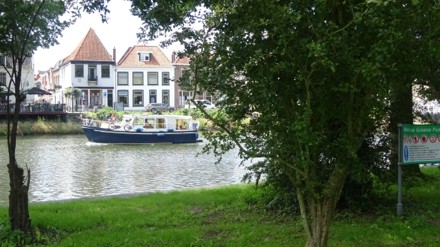
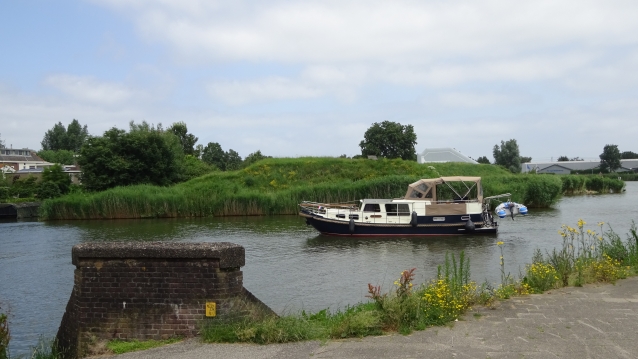
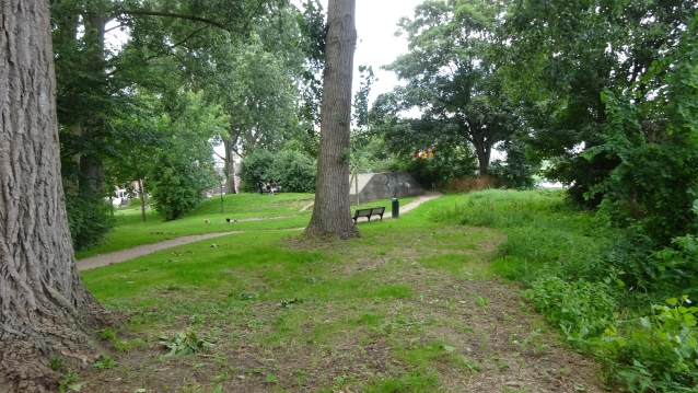
The Groene punt (Green point)
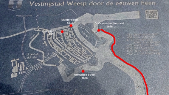
In 1673 (after the French siege), Weesp wants to have eight strongholds built that should protect the city from all sides. For example, around the Ossenmarkt and south of the city, the construction of defensive walls and fortifications was started. Schans ‘De Groene punt’ is one of them. Unfortunately, only four of the eight strongholds were realized due to lack of money.
52°18’31.5″N 5°02’38.1″E
The Slijkstraat (Mudstreet)
Because the industry of Weesp from the 1600 to the 1800th century consisted mainly of producing beer and gin. And because this was made from grain, the rest of the product of elaborated grain and hops usually ended up on the street. This had as a nice side effect that this residual product was eaten by the pigs that walked here. In many cities, there were also many state farms. This was no different in Weesp. Chickens and pigs just walked down the street. The pigs that naturally became mud fat from this still only since alcohol-consisting wastes became naturally within the short time mud fat of this. And so, just like the beer and gin, could also be sold to the V.O.C, who took it on the ships for their long voyages by sea.
52°18’30.5″N 5°02’34.6″E

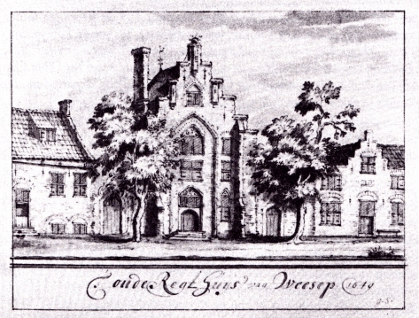
Gemeentehuis Weesperkarspel
Once upon a time, the Town Hall of Weesperkarspel was located here.
Weesperkarspel is a former municipality and was largely located in the Vechtstreek.
The municipality was added to the municipality of Weesp in 1812, and on 1-5-1817 again split off from the municipality of Weesp (at the beginning of the 19th century, many rural areas in our country were – again – split off from the cities into separate municipalities.
In 1848 the municipality was enlarged with the municipality of Bijlmermeer.
As of 1-8-1966, the municipality was dissolved and distributed over a number of surrounding municipalities.
52°18’27.8″N 5°02’36.4″E
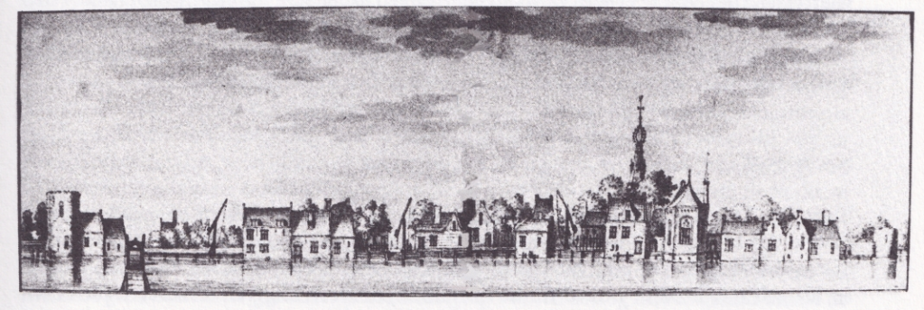
Wooden medieval houses
In the Middle Ages there were wooden houses along the full length on the banks of the vecht.
In the middle of the picture above (near the letter V) you can also see the first town hall (the Regthuys) of Weesp.
52°18’27.8″N 5°02’36.4″E
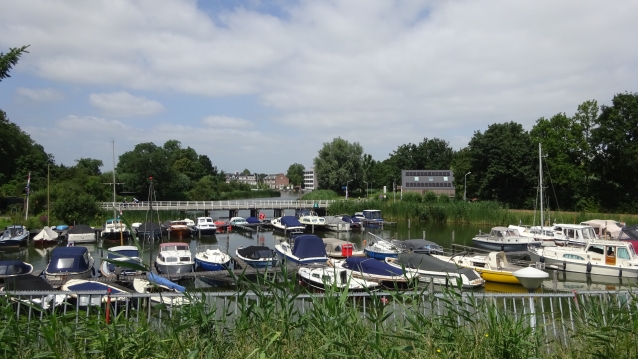
De lange Vechtbrug (The long Vecht bridge)
The bridge crosses the Utrechtse Vecht and connects the Hoogstraat with the Ossenmarkt located on an island in the Vecht.
The name of the bridge refers to the length of the bridge in relation to other bridges over the Vecht.
The Lange Vecht bridge has not always been located in this place.
Around 1600 the bridge was still at the end of the corner Hoogstraat/Achter ’t Vosje.
It was then a pound bridge just like we know from Queen Emma Bridge on Curaçao.
To get to the bridge from Weesp you first had to go through the Klinketpoort. This gate was also called Sint Laurents- or Zuiderpoort.
It was not uncommon for ports to have multiple names. For example, the Muiderpoort was also called Noorderpoort. After the Noordersluis of the same name. And the Geinpoort Amsterdam gate.
The old Lange Vechtbrug and Klinketpoort are clearly visible on the left of the drawing ‘View of the Hoogstraat from over the Vecht’ by Jacob Stellingwerf (1639).
52°18’25.7″N 5°02’42.1″E
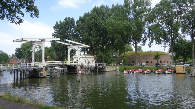
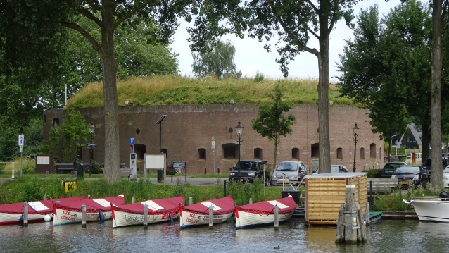
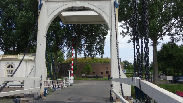
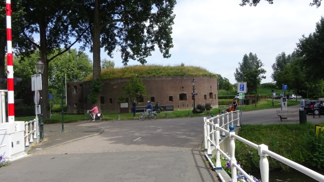
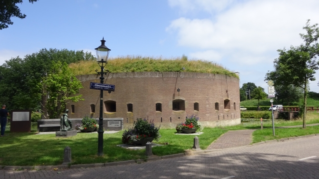
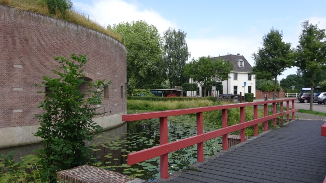
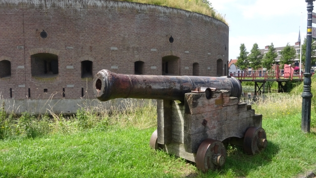
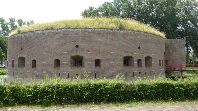

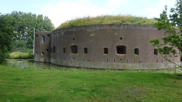
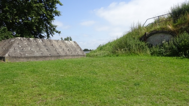
Fort Ossenmarkt (Fortress Ox-market)
The Weesp fortress, like that of Muiden, has been part of the Dutch Water line since the seventeenth century because of its strategic location.
Of the planned eight bastions, only four had been realized at the end of the nineteenth century, when Weesp was added to the new position of Amsterdam. Of the other four, the floor plans can still be recognized in the street pattern of the city, but they were never built.
The characteristic Tower Fort was built in 1861. The construction took about two years. From 1892 the fort was part of the Defence Line of Amsterdam.
In the beginning of the twentieth century, an additional cover wall was built on the east side of the fortress. At the same time, part of the moat was muffled and the drawbridge that gave access to the fort was also demolished.
During the restoration works from 1983 to 1985, the shore was excavated again and the canals and bridge were restored the fortress of Weesp played an important role in the defense of the two banks of the Vecht, the locks in this river and of the railway connection Amsterdam Hilversum with the bridge over the Vecht.
52°18’27.5″N 5°02’45.1″E
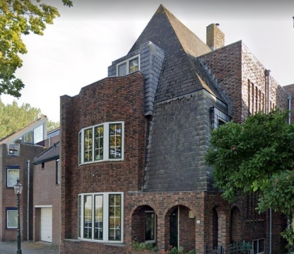
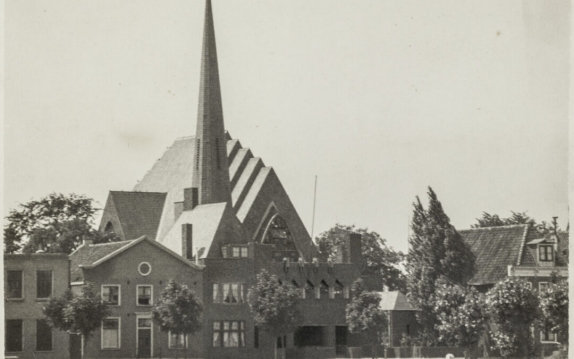

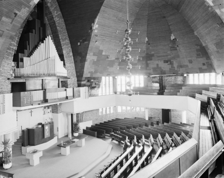
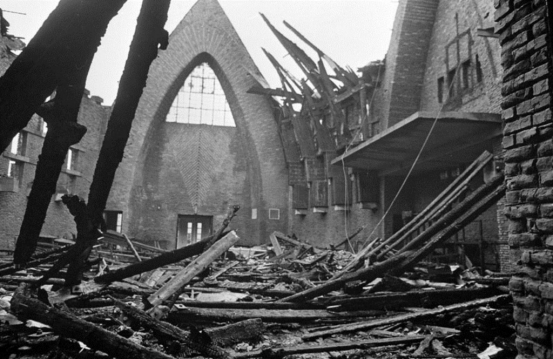
Presbytery and Deaconess
As remnants of the Reformed church building from 1928, which burned down on 3 April 1968, these two buildings have a cultural-historical value for Weesp.
For forty years, this imposing church with its expressionist architecture, a masterpiece by architect Reitsma from the interwar period, helped to measure the cityscape of Weesp.
In the large city fire of April 3, 1968, which raged in a part of the city center, the church also caught fire. The rectory and deaconess were miraculously spared. From the church a lacquered ruin remained
52°18’21.6″N 5°02’45.7″E
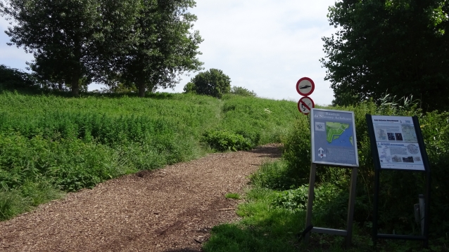
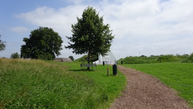

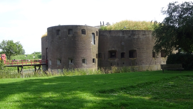
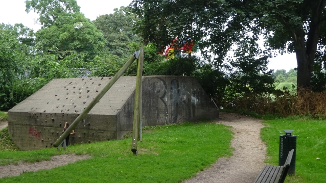
Bastion de nieuwe Agtkant
At Bastion de Nieuwe Agtkant you can literally experience the Waterline yourself. In the centuries-old defensive wall, an opening has been made so that the visitor can walk through the old wall and experience the thickness of such an earthen wall well and can see the differences in height between the 17th and 19th century city wall. And it’s a great way to get to the water that runs around the city! The shore is part of Bastion Nieuw Achtkant, which at the same time as the making of this cross-section, in 2011, has been completely reconstructed to the end of the 19th-century situation.
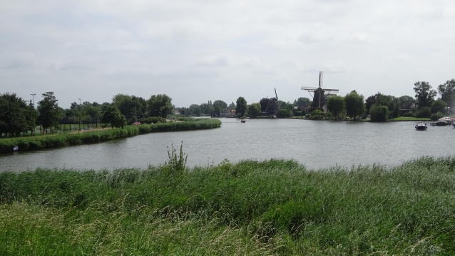
From here you have a beautiful view of the two Mills on the Vecht. See the points further down in this tour Molen de Eendracht and Molen de Vriendschap.
52°18’25.6″N 5°02’54.1″E

Bastion Roozeboom
On the Bastion Roozenboom there is an octagonal wind mill. It is unclear whether the Windmill is named after the bastion or the windmill after the bastion. In place where the Bastion. Assuming that there was also a mill here, we can say that Weesp must have had at least four mills.
On the spot where the Bastion Draaierschans and Bastion Roozenboom meet, the Stadspoort used to be ‘De Utrechtse poort’
52°18’16.8″N 5°02’49.7″E
Vuurlinie huisjes (Fireline houses)
One of the regulations around the Bastions was a free field of shooting. Also called the line of fire, it was not allowed to be built within the reach of the Line of Fire. For a long time it was not built here and you must have had a beautiful view over the fields. And you could see the enemy coming from afar. At the end of 1800, the regulations became more flexible and the Utrecht road, which is on the other side of the water, was allowed to be built.
These houses had to be built of wood. So that as they approached the enemy, they could be quickly set on fire in order to get an open field of fire again. That’s why these houses are called Line of Fire houses
52°18’14.4″N 5°02’45.1″E
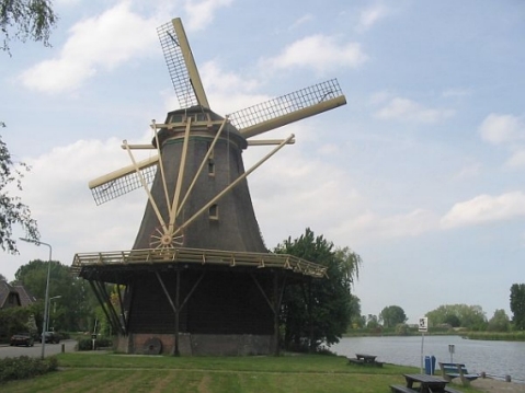

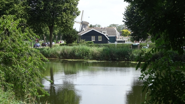
Mill de Vriendschap
The predecessor of De Vriendschap was built in 1694 by four millers and brandy burners on the east side of Weesp as a mill. On September 23, 1899, the old mill burns down as a result of lightning. Because in 1860 miller Wouterus van den Akker, then miller at mill ’t Haantje on the Stammerdijk in Weesp, bought the mill. The Van den Akker family would keep the mill and the milling company in possession for no less than eighty years.
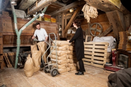
De Vriendschap is a windmill built in 1900 on the site of the mill burned down in 1899On December 31, 1940, De Vriendschap is sold to C. Otten, known from Otten’s Oliefabrieken in Weesperkarspel. After the war, the mill fell into disrepair. Until the municipality of Weesp bought it in 1974 and after a thorough restoration in 1977 it was put back into use. Since its restoration in the seventies, the mill has developed into a traditional milling company that is affiliated with the Ambachtelijk Molenaars Gilde.
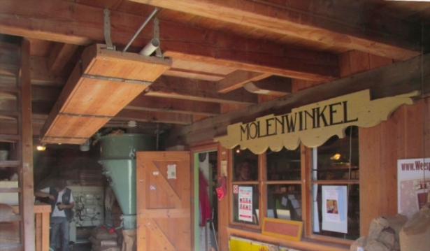
De shop of this mill is open every Saturday from 10:00 to 16:00.
52°18’14.7″N 5°02’59.1″E
Gallows field Utrechtseweg
There were probably two gallows fields in Weesp. One on the Utrechtseweg, approximately where the mills are now, and one on the Papelaan, in the Bloemendalerpolder. We know very little about the first one, on the Utrechtseweg.
Because it was one of the access roads to the town of Weesp, it was a medieval custom to hang a convicted person on this road as a warning.
52°18’13.1″N 5°03’02.3″E
Windmill de Eendragt
This former malt mill was built in 1691.
Around 1807 the mill was converted into a shell sand mill and in 1815 it was converted into a sawmill again. Restoration mill d’ Eendragt 1952
52°18’13.1″N 5°03’02.3″E
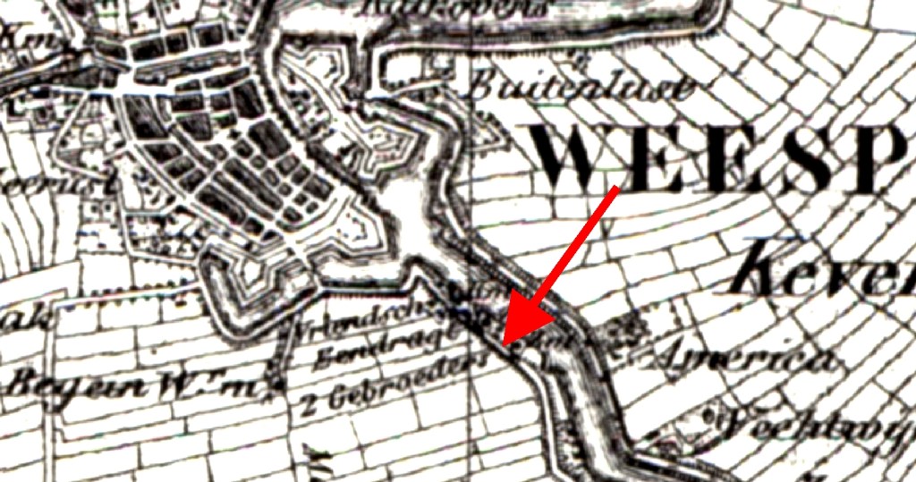
Mill de 2 Gebroeders (the 2 Brothers)
Once there were three mills here.
In 1835, the Van den Bergh brothers decided to build a sawmill next to the Eendragt. This mill was identical to the Eendragt. So he was very appropriately named the 2 Brothers.
This mill did not stand here for long because in 1851 it was demolished again.
52°18’13.1″N 5°03’02.3″E
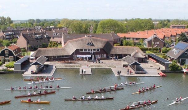
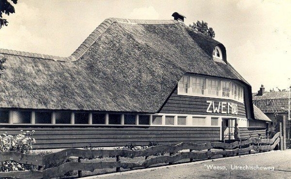

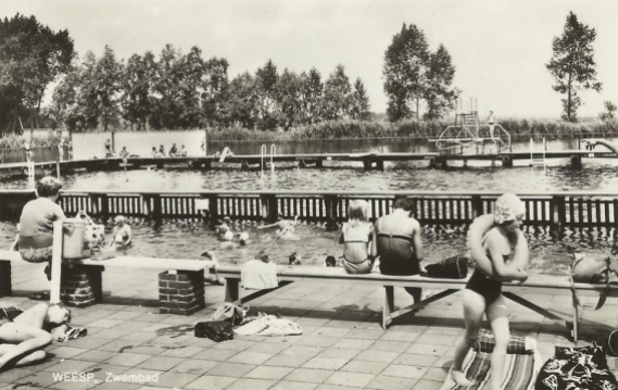
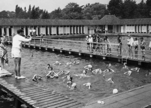
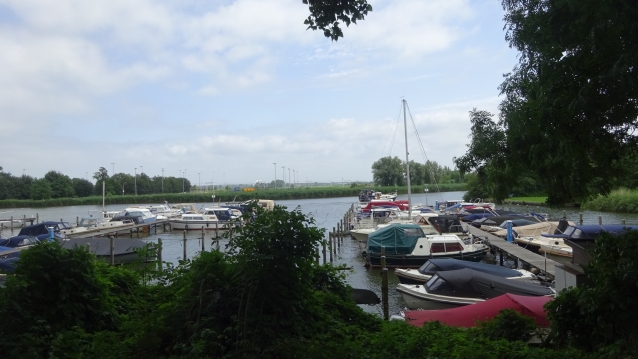
The old swimming pool and rowing club Weesp
In 1936 this building was built as a swimming pool designed by the then municipality architect Kors Breijer. Many Weespers have learned to swim here. Around 1964 the bath had to close because the Vecht water was too contaminated. Now Roeivereniging Weesp is housed here, which was founded on May 10, 1978 in Weesp, and has its boathouse at this beautiful location on the Vecht
52°18’12.0″N 5°03’06.2″E

‘s-Gravelandseweg
The ‘s-Gravelandseweg is one of the oldest roads that lead to Weesp. It used to be around 1500 that it was the road from Amsterdam to Utrecht. If you approached Weesp from this side you could go via the ’s Gravenlandsepoort the city of Weesp. The ’s Gravenlandsepoort that was built in 1676 was one of the four gates that Weesp has known. And that Weesp protected together with the Utrechtsepoort on the other side of the over.
52°17’59.0″N 5°03’31.4″E
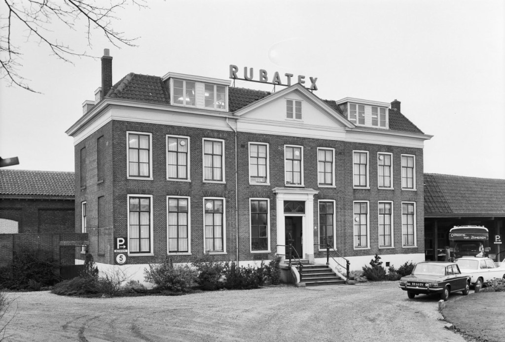
Buitenplaats Veldzicht
The house was built in 1830 in neo-classicist style by order of the mayor of the former municipality Weesperkarspel.
In 1850 an iron foundry of the firm Becht & Dyserinck was established on the grounds of the estate. In the fifties, the complex was expanded with a new industrial hall. In 1960 Becht & Dyserinck was taken over by latex manufacturer Rubatex. It went bankrupt in 1994. . The factory buildings and the mansion fell into disrepair.
52°17’49.6″N 5°03’44.7″E
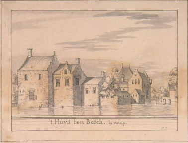
Castle Huys ten Bosch
The disappeared Huis Ten Bosch was a moat castle with a front castle and a main castle. It was probably built in the first quarter of the 13th century. The founder of the castle is probably Egbertus van den Bosch (± 1180-1227) also called Egbertus van Amstel.
The castle has had a fascinating history. But has also been besieged, destroyed and rebuilt four times: in 1408, 1426, 1514 and 1672.
The end of Huis Ten Bosch comes in the disaster year 1672. The French enter the Netherlands and approach Weesp to the edge of the Waterline. Weesp is on the safe side of the Waterline, but Huis Ten Bosch is on the other side of the water. The French remain stuck on the other side of the water for a whole winter and, in anger, set fire to and demolish many castles and other precious property. This also applies to Huis Ten Bosch.
52°17’28.4″N 5°04’19.6″E
End of this tour.
Time for a drink at Paviljoen Uit & Meer
Thanks for doing this tour
Also try The Fort Uitermeer Tour
Sources, photos and quotes: commons.wikimedia.org, upload.wikimedia.org, wikipedia.org, knrb.nl, hkweesp.nl, plaatsengids.nl, NH nieuws, molendatabase.nl, tripadvisor.nl, Parool.nl, makelaarweesp.com, rvweesp.nl, WSPRMP If this list is not complete, please let us know at wsprmp@outlook.com
Intellectual property of
Berry van Raay, WSPRMP Weesp
